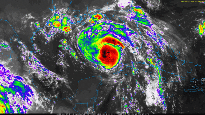
Hurricane Ida has yet to become a major hurricane, but is expected to do so late this evening heading into the overnight hours of Sunday. Forecasters are expecting Ida to strengthen to a Category 3 hurricane by the time it makes landfall on the United States. Ida is currently moving away from Cuba at a NW speed of 16mph. Although that seems rather slow, this is a good sign for it to move away from Cuba as in years past, they have struggled with stationary hurricanes that have sat over top of the country.
The threat for dangerous storm surge continues for the southern states of Mississippi, Louisiana, and Alabama. The National Hurricane Center mentioned in this morning’s update “Extremely life-threatening inundation of 10-15 feet above ground level is possible.” Residents or visitors of the targeted areas, NHC says “should follow any advice given by local officials.”
As this moves closer to the United States, forecasters will be better able to predict the exact path of where Ida will move. Right now, it is expected that Tennessee will get lots of scattered thunderstorms and rain around Wednesday. The National Weather Service has predicted that Middle Tennessee will receive around 3-4″ of moderate rain and if you live west of I-65, expect a great amount of rainfall, potentially between 6-8″.
For more updates and information, follow the link to the NHC website here.


